JAMES RIVER CATS
Catfishing for the Blues on the James River in Virginia.
The Lower James River Landings/Ramps
Maps & Access
Public boat access in the freshwater fishing section the tidal James River is available at:
- Ancarrow Landing, in Richmond Map
- Osborne Landing in Henrico County Map
- Dutch Gap in Chesterfield County Map
- Deep Bottom in Henrico County Map
- Chickahominy Riverfront Park in James City County Map
- Lawnes Creek Landing in Surry County
Map
- Morris Creek Landing Off the Chickahominy River Map
Private (fee) ramps are available at:
- Jordan Point Marina downriver of Hopewell at the Benjamin Harrison Bridge Map
**Note** Jordan Point Ramp has a deep pot hole (under water) in the center of the ramp. Keep close to the walkway/building when putiing in or taking out your boat.
- Hopewell City Marina Map
- Several smaller private marinas and landings
Deep Bottom Landing
So where do you start??
Well the landing I perfer is Deep Bottom. The landing is in a public park....
A very popular landing to put in on the James is Deep Bottom
Check out the photos/slideshow of Deep Bottom Park
Deep Bottom Park, 9525 Deep Bottom Road, is along the James River in and unusually deep section of the river in eastern Henrico County at Four Mile Creek near Curles Neck. The park has picnic shelters, restrooms, a boat landing, parking lot large enough for boat trailers, canoe launch along Four Mile Creek and fishing opportunities
Directions to Deep Bottom from I-95. Map
- Take exit 61A to merge onto W Hundred Rd/VA-10 E toward Hopewell
4.4 mi 7 mins
- Merge onto I-295 N via the ramp to Washington
7.0 mi 7 mins
- Take exit 22A to merge onto New Market Rd/VA-5 E toward Charles City
1.7 mi 2 mins
- Turn right at Kingsland Rd
0.8 mi 1 min
- Turn left at Deep Bottom Rd
1.2 mi 4 mins
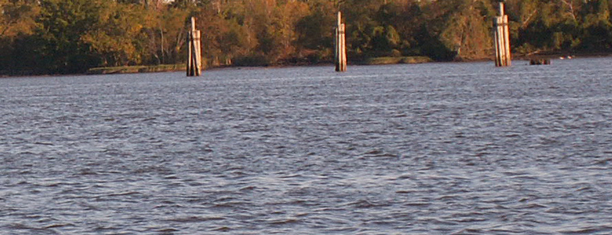
Dutch Gap
Landing
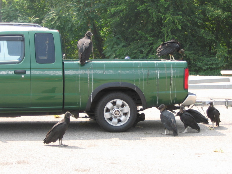
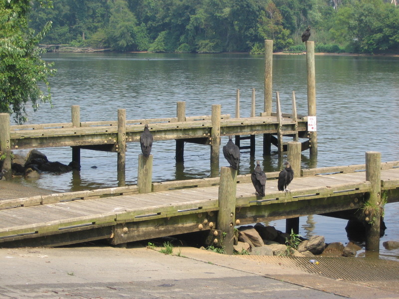
**Note** No reports of any problems with
Black Vultures since
2008, just be careful about leaving any kind of trash in the back of your truck.
Dutch Gap Black Vulture Management
Captain Hugh Self likes to put in at Dutch so when we met up with him
in 07 & 08 we would always cover the truck with a tarp.
October
2007:
Well this could be your truck, that is if you park at the Dutch Gap Landing on the James River. As of Oct 30, 07, they are back, the black vultures of Dutch Gap, and their presence is as perplexing as any Halloween mystery. You can kill them, but they keep coming back. At a boat landing on the James River near Chester, the big black birds scratch and defecate on parked vehicles. They also cause problems at a power plant next door. Over the past seven years, the damage has run into the tens of thousands of dollars.
Directions & map to Dutch Gap
1350 John Tyler Highway Map
Williamsburg, VA 23185
(757) 258-5020
- Ramp (fee)
- Camping (fee)
- Pool
- Store
- Storage
River's Rest Marina & Resort
9100 Wilcox Neck Rd Map
Charles City, VA 23030
Phone: (804) 829-2753 Located approximately half way between Richmond and Newport News, River's Rest Marina & Resort offers a first class marina, comfortable lodging and dining in a secluded Chickahominy River waterfront setting. With its close proximity to Williamsburg, other nearby attractions and on-premises water sports, River's Rest has something to please every member of the family.
The River's huge blue catfish also attract a lot of attention . But best of all, the Chickahominy offers angling variety for a number of different species.
The Chickahominy Wildlife Management Area/ Morris Creek Landing
Parking areas are located along routes 623 and 621 as well as along some of the interior roads. An excellent public boat ramp on Morris Creek gives boating and fishing access to the creek and the Chickahominy and James Rivers. Trails mowed to benefit wildlife also invite hikers. A well developed sighting-in range for rifle and shotgun shooters is a popular feature of this area.
The Chickahominy Wildlife Management Area is most readily approached from state route 5 eight miles east of Charles City Courthouse, at Rustic. Here, take route 623 north. The area may also be approached from U.S. Route 60 at Providence Forge by taking State Highway 155 south; then left onto route 614,
left again on 615 and bear right onto 623. Consult the
map for greater detail.
|